Washington State Property History and Historical Map Resources Guide
- Beth Mathews
- Jul 24, 2022
- 4 min read
Most of our reports include a comprehensive review of historical maps so that we can understand the development history of a property, typically focusing on the Territorial period (starting with American settler land claims) to the modern period (1972 is where our 50-year historic threshold is at in 2022). We do this to identify any association between a property and significant historical events and persons, which informs our archaeological fieldwork methodology (i.e. where we look and how) and also helps us understand whether or not any archaeology on the property could be associated with significant historical events (e.g. a homestead or early settler residence, a locally or regionally important mill, a logging camp or railroad). Establishing a development history also helps us understand how disturbed the soil and sediment on a property might be, and where our best chances of finding intact archaeology are on a property.

Here are some of the main resources we use:
Territorial-Period History
Bureau of Land Management General Land Office Records
This database is the place to go when you're looking for General Land Office survey plats or looking to identify who initially patented a property. Many of the first surveys date to the 1850s to 1860s, although in some lands more difficult to survey/homestead, the plats may date as late as the 1890s.
GLO Patents
GLO Surveys
Willamette Meridian, Oregon and Washington States, Bureau of Land Management General Land Office Records
This database is a precursor to the national webpage. It provides some extra tools like historical indices and master title plats. Most useful for someone researching early settler history are the cadastral survey notes. They can provide information on platted and unplatted cultural places encountered by the surveyor, which can include Tribal properties, trails, etc.
National Archives Land Entry Records
This is where you can order land entry records from the National Archives and Records Administration. You can use the BLM GLO website to identify basic information like the location, document numbers, and patentee (owner). Then you can order the land entry file which may provide you with additional information about the patent process. These documents include affidavits, receipts, sometimes plats or photos of a property, claimant testimony, and other legal documents. It will cost $50 and you'll have to wait about 30-60 days, but you'll get a digital copy emailed directly to you. You can also contract with researchers local to D.C. who might get them to you faster.
GLO Tract Books
Land office tract books record filing and patent details for Homestead claims. These books can help you identify when a patentee began occupying their claim. Many claimants did not satisfy the requirements of the Homestead Act, so a review of these tractbooks can help you establish who might have made the original Homestead "improvements" to a property. Although some scanned tractbooks are available on the GLO database, this is a comprehensive source for tractbooks in Washington State. Requires a free log-in account.
Washington Census Records
The Washington State Archives online collections include many early census records for Oregon/Washington Territory. Most are scanned and searchable. These can help you trace an immigration date of a historic person, determine how long they lived in an area (addresses aren't there but you can usually figure it out based on their neighbors), and details about families and occupations.
Property Records
Washington Land Records
These scanned volumes, from 1852 to 1925, show land deed transfers for several western Washington counties. Requires a free log-in account.
Assessors Offices
Search for a property parcel to find information on the age of buildings on a parcel. Here are a few links for western Washington:
Historic Property Inventory
The Department of Archaeology and Historic Preservation maintains a database of historic places, which includes register-listed properties and properties over 50-years old.
Early 1900s to 1970s Residential History
USGS Historical
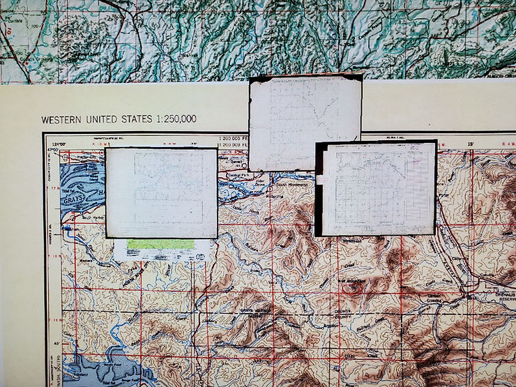
USGS has a great explorer app for USGS historical maps. Search or scroll to find your location of interest. Click on your research location, and a list of available (georeferenced) map layers will come up. You can download these for import into mapping software.
USGS Historical Topographic Maps
Historic Map Works
Historic Map Works sells prints of historic maps, including atlases like Anderson, Kroll, Metsker, Ogle, and Plummer. You can browse these and although the online viewer includes a watermark they are still very useful for establishing property ownership history, particularly mid-Century ownership.
Sanborn Fire Insurance Maps
If you're researching a property that is within a town or city core, there's a good chance there's a Sanborn map for that. This database has fabulous detailed insurance maps for locations across Washington, dated to the late 1800s to early 1900s. These are invaluable for their detail on the historic setting of a property/neighborhood.
Polk Directories
Polk Directories provide business and resident addresses. The Washington State Archives has several Polk Directories available online in their miscellaneous family history collection.
Washington State Coastal Atlas
The Department of Ecology maintains a database that includes 1976 to 2017 aerial photos of shorelines in Washington State, which includes the coast, Puget Sound, rivers, and lakes. These photos can help establish the age or condition of historic properties or landscape modifications.
Google Earth
Download Google Earth Pro to access historic aerial images.
Historic Aerials by NetrOnline
This is a quick all-in-one viewer with USGS maps, aerials, and limited atlases. Full of watermarks and requires a subscription.
Central Washington Historical Aerial Photograph Project
1940s/1950s aerial imagery for Benton, Douglas, Grant, Kittitas, and Yakima counties. Browse the map to view available imagery.


Comments